Next week marks the 91st anniversary of the Great Kanto earthquake which devastated Tokyo and surrounding areas.
Working with data from the Tokyo Metropolitan Government, we’ve just made a crisis preparedness map available that we hope will help residents prepare for crises in the future.
With this new map, inhabitants of Japan’s largest city can now easily view information about their community’s vulnerability to risks like building collapse and fire hazard resulting from earthquakes. The data also shows the level of difficulty of conducting emergency response operations in certain communities based on existing roadway networks.
You can learn more about this and our other crisis response tools for Japan at: www.google.org/crisisresponse/japan.
Posted by Hideto Kazawa, Senior Engineering Manager, Google Japan
Working with data from the Tokyo Metropolitan Government, we’ve just made a crisis preparedness map available that we hope will help residents prepare for crises in the future.
With this new map, inhabitants of Japan’s largest city can now easily view information about their community’s vulnerability to risks like building collapse and fire hazard resulting from earthquakes. The data also shows the level of difficulty of conducting emergency response operations in certain communities based on existing roadway networks.
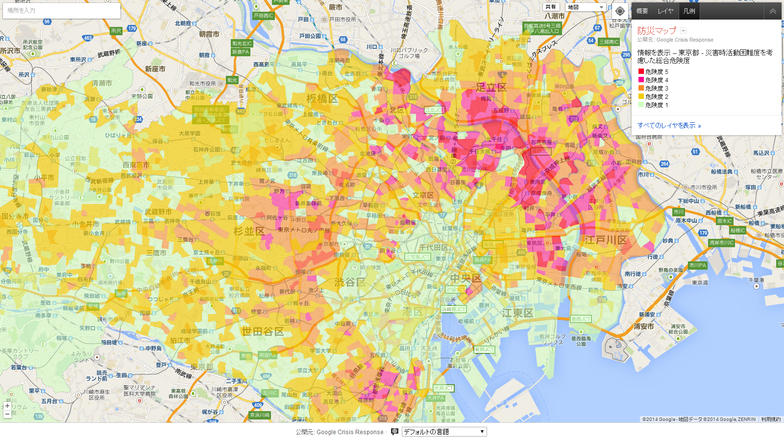 |
| Map includes evacuation areas, safe zones, building collapse risk, fire risk and risk level related to the ease or difficulty of conducting emergency response operations |
Posted by Hideto Kazawa, Senior Engineering Manager, Google Japan
No comments:
Post a Comment