Cross-posted from the Google Australia blog
From the snow-capped summit of Mount Kosciuszko, to the beaches at Bondi and the seafloor of the Great Barrier Reef, every person can explore our country’s most beautiful locations on Google Maps.
To celebrate the once-in-a-decade IUCN World Parks Congress that’s taking place in Sydney this week, we’ve partnered with New South Wales National Parks and Catlin Seaview Survey to bring 21 parks and 27 underwater locations across Australia to Street View.
Beyond Mount Kosciuszko, bushwalkers can take a virtual hike through Fort Denison, Dorrigo National Park, Ku-ring-gai Chase, Cape Byron lighthouse and 16 other parks across New South Wales.
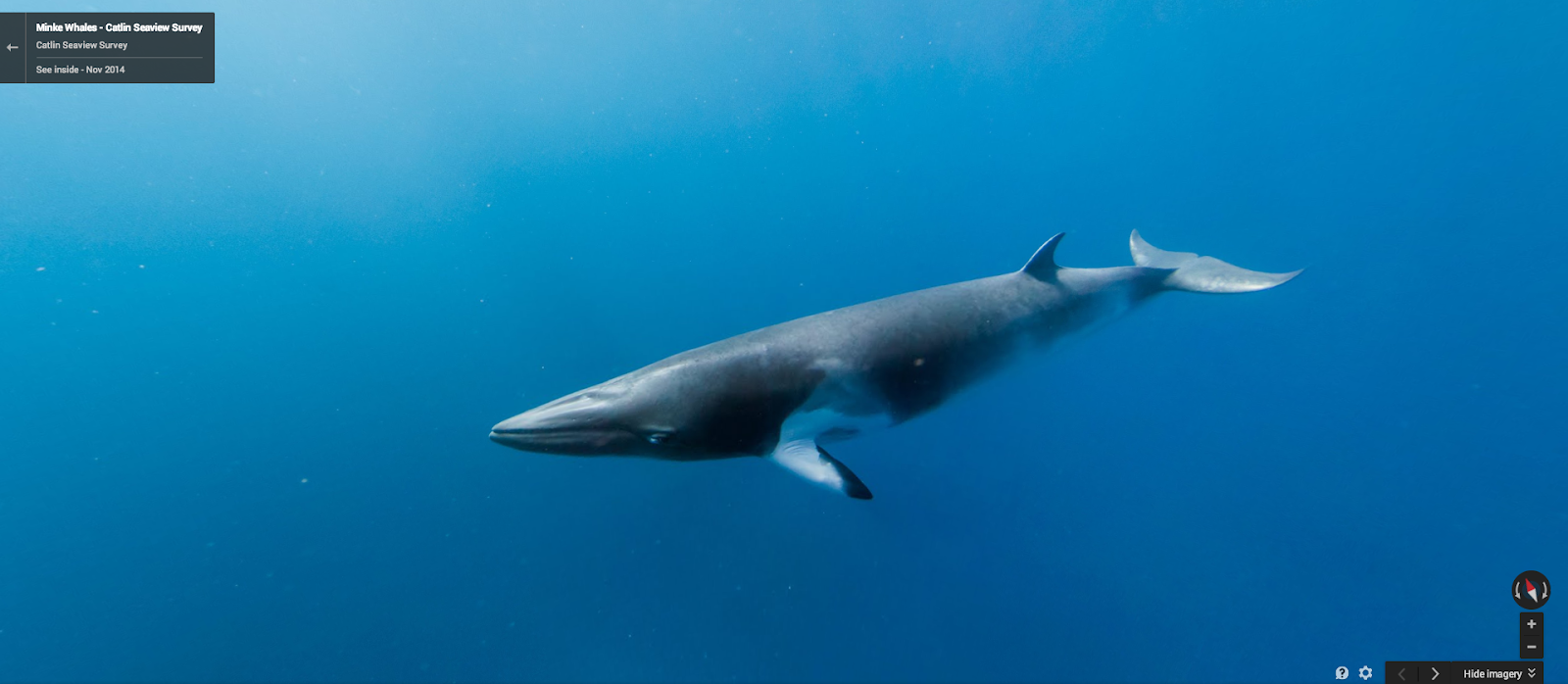
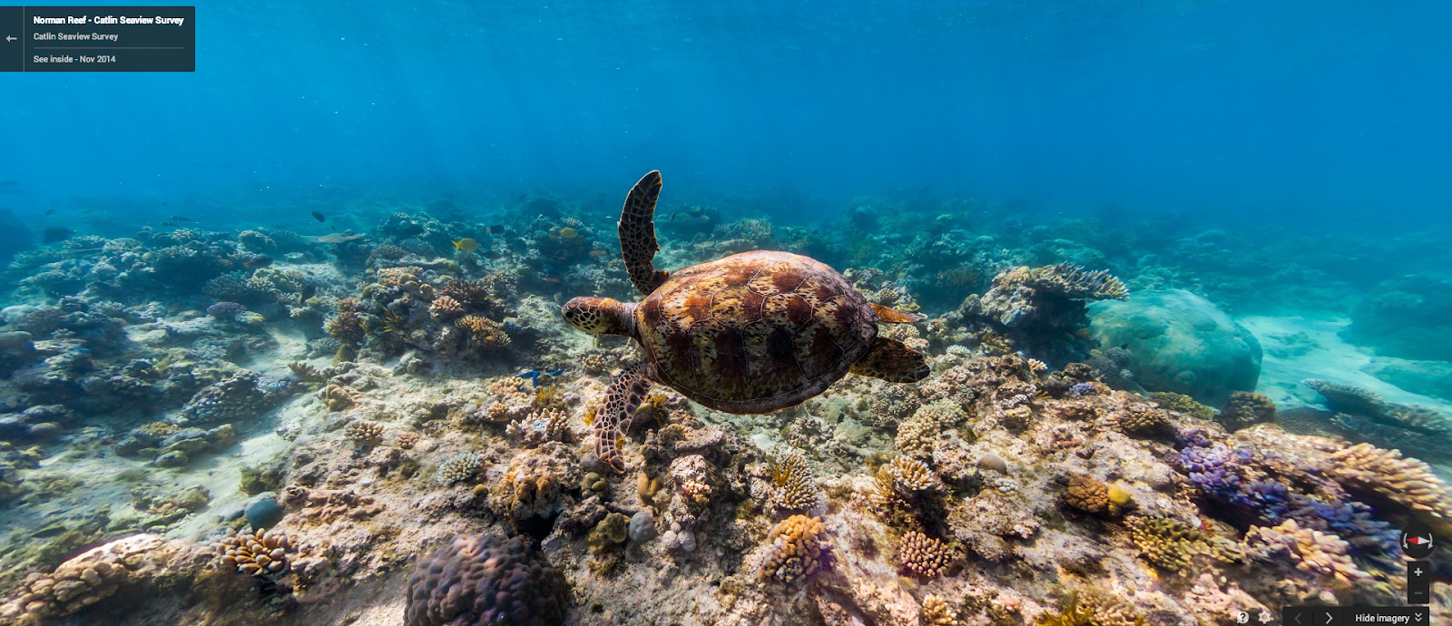
Divers can get up close with Minke whales, a seahorse in Chowder Bay, Magic Point sharks, dolphins near Myrmidon Reef and even a Norman Reef sea turtle.
From the depths of Sydney Harbour to the iconic Bondi Beach and all along the Great Barrier Reef, we hope you enjoy exploring these locations from a whole new perspective.
We hope this new Street View imagery not only inspires adventure, but that it also helps people to learn more about the delicate ecology of our parks and underwater worlds.
From the snow-capped summit of Mount Kosciuszko, to the beaches at Bondi and the seafloor of the Great Barrier Reef, every person can explore our country’s most beautiful locations on Google Maps.
To celebrate the once-in-a-decade IUCN World Parks Congress that’s taking place in Sydney this week, we’ve partnered with New South Wales National Parks and Catlin Seaview Survey to bring 21 parks and 27 underwater locations across Australia to Street View.
Beyond Mount Kosciuszko, bushwalkers can take a virtual hike through Fort Denison, Dorrigo National Park, Ku-ring-gai Chase, Cape Byron lighthouse and 16 other parks across New South Wales.
 |
| At the summit of Mount Kosciuszko |
 |
| Looking over the cannons at Fort Denison |
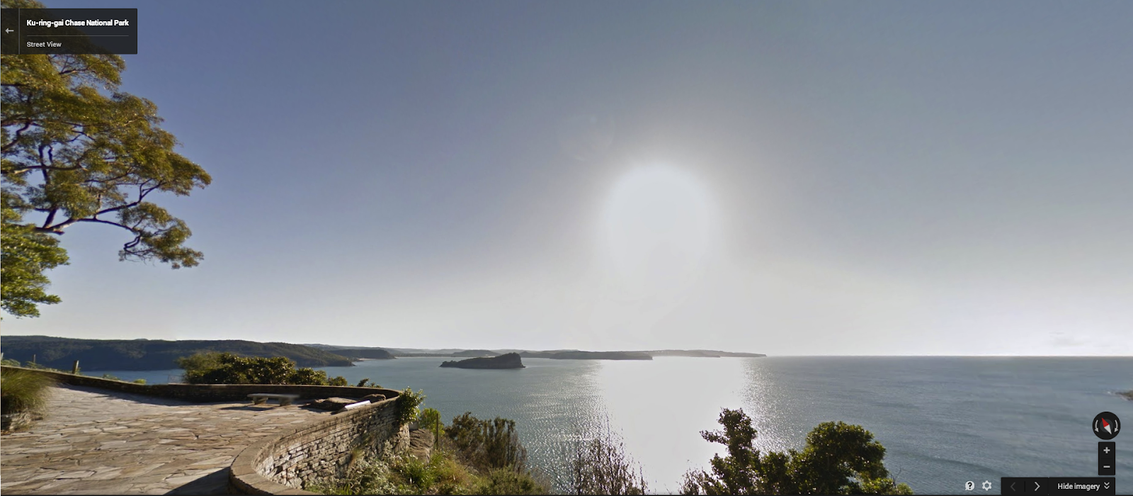 |
| West Head Lookout at Ku-ring-gai Chase National Park |
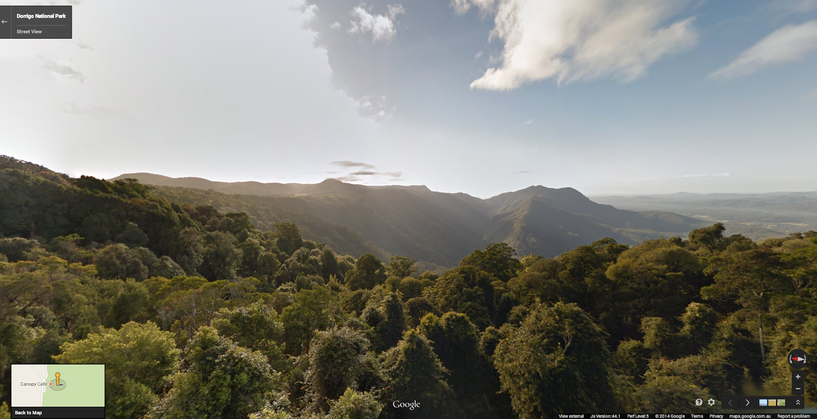 |
| The view over Dorrigo National Park |
Divers can get up close with Minke whales, a seahorse in Chowder Bay, Magic Point sharks, dolphins near Myrmidon Reef and even a Norman Reef sea turtle.
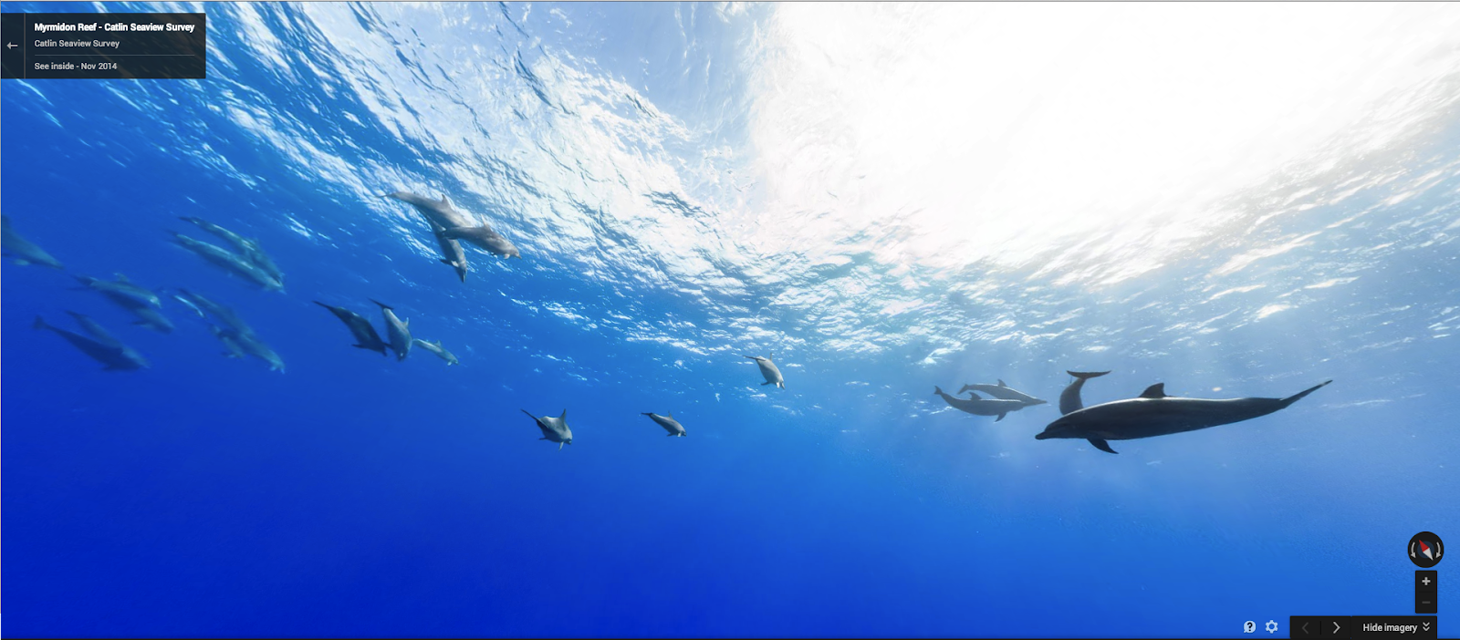 |
| Dolphins off Myrmidon Reef |
From the depths of Sydney Harbour to the iconic Bondi Beach and all along the Great Barrier Reef, we hope you enjoy exploring these locations from a whole new perspective.
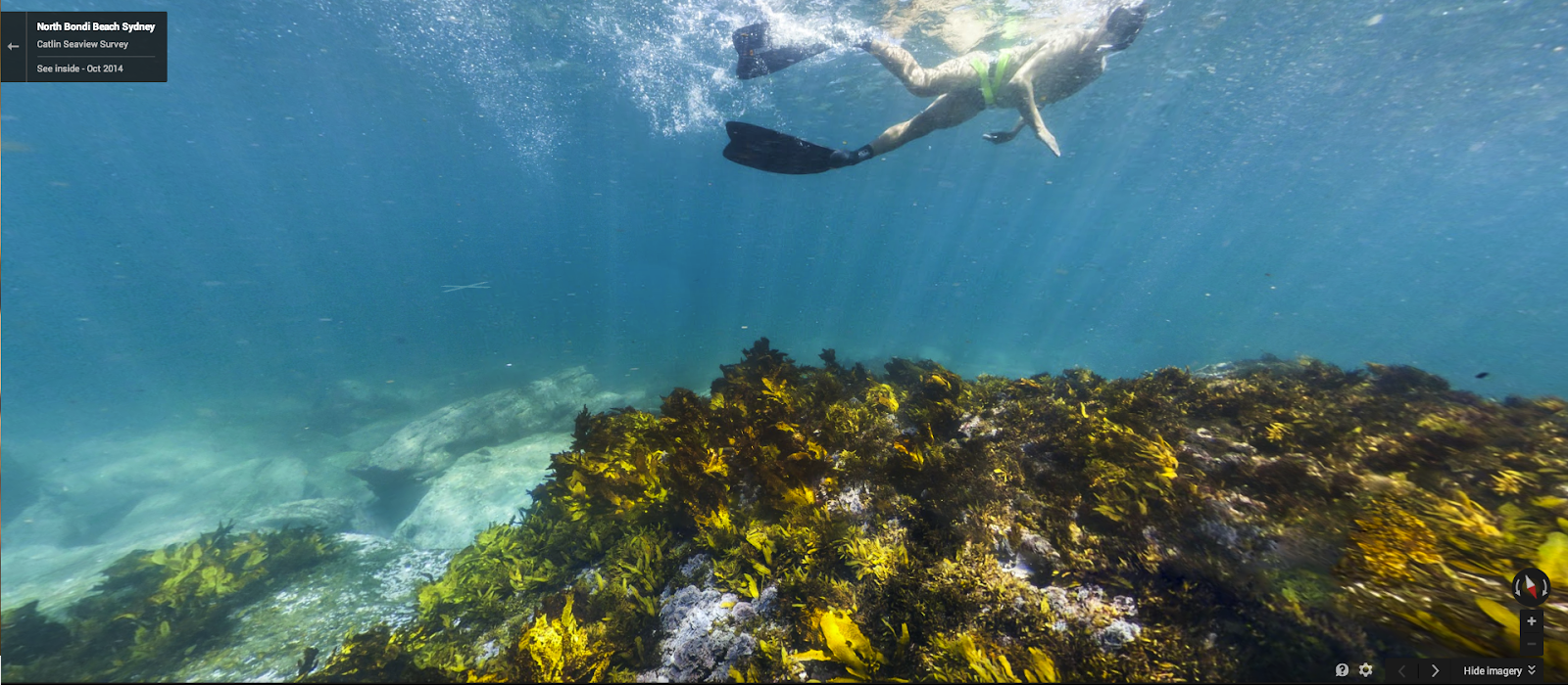 |
| Beneath the waves at Bondi Beach |
We hope this new Street View imagery not only inspires adventure, but that it also helps people to learn more about the delicate ecology of our parks and underwater worlds.
this is extra
ReplyDeleteda
ReplyDeleteBeautiful
ReplyDelete